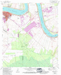
1962 Map of Donaldsonville
USGS Topo · Published 1994About this map
The Mississippi River defines the landscape of this river-parish region, where massive bends like Point Houmas and Bringier Point dictate the layout of early settlements and agriculture. In the early 1960s, the area reflects a deep-rooted plantation economy transitioning into the industrial era, with prominent estates such as Dugas Plantation, St Mary Plantation, and Delia Plantation still clearly identified. The city of Donaldsonville serves as the focal point, positioned at the head of Bayou Lafourche.
Find a feature on this map
36 named features on this map. Tap any name to fly to it.
Don’t see what you’re looking for? This feature index may not catch every label — zoom into the map to look around manually.
Map Details
Editions of this 1962 Donaldsonville Map
4 editions found
Other maps of this area

1892 · Donaldsonville
USGS Topo · 1:62,500

1892 · Thibodaux
USGS Topo · 1:62,500

1927 · Thibodaux NW
USGS Topo · 1:31,680

1932 · Thibodaux NE
USGS Topo · 1:31,680

1935 · Gonzales
USGS Topo · 1:31,680

1936 · White Castle
USGS Topo · 1:62,500

1939 · Donaldsonville
USGS Topo · 1:62,500

1940 · Lagan
USGS Topo · 1:31,680

1940 · Madewood
USGS Topo · 1:31,680

1945 · New Orleans
USGS Topo · 1:250,000