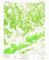
1963 Map of Dongola
USGS Topo · Published 1964About this map
Castor River and the engineered Diversion Channel dominate the southern lowlands of this Bollinger County landscape. In the early 1960s, the transition from the rugged northern hills to the flat alluvial plains is marked by significant water management features, including a prominent Levee and Crater Ditch. Small rural centers such as Dongola and Drum are central to the local geography, while the upland areas are dotted with community landmarks like New Sylvan Ch and Little Valley Ch. Genealogists will find several family-named burial grounds, including Mansker Cem and Kellion Cem. The natural drainage of Dry Creek and Malone Creek feeds into the wetlands of the Dark Cypress Swamp and the secluded Goose Pond, illustrating the complex hydrology of the region before further modern developments altered these bottomlands.
Find a feature on this map
28 named features on this map. Tap any name to fly to it.
Don’t see what you’re looking for? This feature index may not catch every label — zoom into the map to look around manually.
Map Details
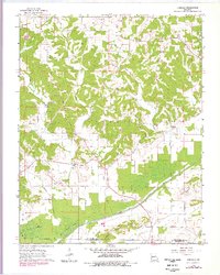
Editions of this 1963 Dongola Map
2 editions found
Other maps of this area

1933 · Marble Hill
USGS Topo · 1:62,500

1933 · Marquand
USGS Topo · 1:62,500

1934 · Advance
USGS Topo · 1:62,500

1935 · Zalma
USGS Topo · 1:62,500

1937 · Marble Hill
USGS Topo · 1:62,500

1938 · Marquand
USGS Topo · 1:62,500

1939 · Advance
USGS Topo · 1:62,500

1939 · Zalma
USGS Topo · 1:62,500

1949 · Paducah
USGS Topo · 1:250,000

1949 · Rolla
USGS Topo · 1:250,000