
1939 Map of Doniphan
USGS Topo · Published 1958About this map
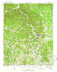
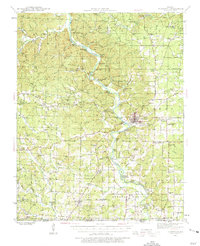
Current River meanders through the center of this Ripley County landscape, serving as the primary axis for development in the late 1930s. The town of Doniphan acts as the regional hub, where the Missouri Pacific railroad terminates near the riverbank. This era shows a densely populated rural backcountry, evidenced by a high concentration of schoolhouses like Pleasant Grove Sch, Price Sch, and Rosson Sch distributed across the hollows. To the west, the Clark National Forest boundary marks a shift toward more wooded, dissected terrain. Riverside tourism and local industry are visible through named clusters such as Matthews Cabins, Moreys Cabins, and the Bluff Cottage settlement. Along the southern border, the community of Current View sits directly on the Missouri-Arkansas state line, while Macedonia Lookout provides a high-point vantage over the forested ridges of Barren Hollow and Buffalo Hollow.
Find a feature on this map
110 named features on this map. Tap any name to fly to it.
Don’t see what you’re looking for? This feature index may not catch every label — zoom into the map to look around manually.
Map Details
Editions of this 1939 Doniphan Map
3 editions found
Other maps of this area

1934 · Williamsville
USGS Topo · 1:48,000

1935 · Acorn
USGS Topo · 1:62,500

1935 · Knobel
USGS Topo · 1:62,500

1935 · Reyno
USGS Topo · 1:62,500

1940 · Williamsville
USGS Topo · 1:62,500

1940 · Naylor
USGS Topo · 1:62,500

1941 · Gatewood
USGS Topo · 1:62,500

1941 · Knobel
USGS Topo · 1:62,500

1944 · Naylor
USGS Topo · 1:62,500

1944 · Van Buren
USGS Topo · 1:62,500