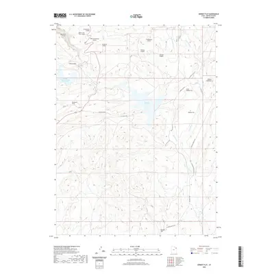
2020 Map of Donkey Flat
USGS Topo · Published 2020About this map
Red Fleet Reservoir dominates the central landscape of this Uintah County survey, serving as a focal point for water management and recreation in the high desert. The map captures a sophisticated network of industrial and agricultural water infrastructure, most notably the Redfleet Aqueduct and the large Stauffer Chemical Tailings Pond North located near Camp Canyon. To the east, the level expanses of Donkey Flat and Little Donkey Flat provide a stark contrast to the deeply incised drainages like Big Brush Gorge and Hole in the Wall Canyon. Local ranching history is evidenced by Diamond Hills Ranch and the winding course of Brush Creek. The geography here is defined by complex erosional features, from the Buckskin Hills in the south to the labyrinthine systems of Jackpot Canyon and Constantine Canyon to the north.
Find a feature on this map
28 named features on this map. Tap any name to fly to it.
Don’t see what you’re looking for? This feature index may not catch every label — zoom into the map to look around manually.
Map Details
Editions of this 2020 Donkey Flat Map
This is the sole edition of this map. No revisions or reprints were ever made.
Other maps of this area

1885 · Ashley
USGS Topo · 1:250,000

1906 · Marsh Peak
USGS Topo · 1:125,000

1907 · Jensen
USGS Topo · 1:125,000

1908 · Marsh Peak
USGS Topo · 1:125,000

1910 · Jensen
USGS Topo · 1:125,000

1917 · Vernal
USGS Topo · 1:125,000

1950 · Burnt Cabin Gorge
USGS Topo · 1:24,000

1950 · Blair Basin
USGS Topo · 1:24,000

1950 · Dyer Mountain
USGS Topo · 1:24,000

1954 · Vernal
USGS Topo · 1:250,000