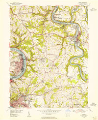
1954 Map of Donora
USGS Topo · Published 1955About this map
The Youghiogheny River and Monongahela River dominate this mid-century industrial landscape, framing a dense network of rail lines and mining operations. The Baltimore and Ohio and Pittsburgh and Lake Erie railroads parallel the riverbanks, serving the heavy industry concentrated in Donora and Monessen. Away from the riverfronts, the terrain rises into the coal-rich hills of Rostraver, where Coal Hollow Mine and the Equitable Mine sit alongside evolving suburban developments like Pricedale and Lynnwood.
Find a feature on this map
116 named features on this map. Tap any name to fly to it.
Don’t see what you’re looking for? This feature index may not catch every label — zoom into the map to look around manually.
Map Details
Editions of this 1954 Donora Map
4 editions found
Other maps of this area

1902 · Brownsville
USGS Topo · 1:62,500

1902 · Connellsville
USGS Topo · 1:62,500

1904 · Mc Keesport
USGS Topo · 1:62,500

1904 · Greensburg
USGS Topo · 1:62,500

1906 · Brownsville
USGS Topo · 1:62,500

1906 · Greensburg
USGS Topo · 1:62,500

1907 · Pittsburg
USGS Topo · 1:62,500

1931 · Brownsville
USGS Topo · 1:62,500

1931 · Connellsville
USGS Topo · 1:62,500

1933 · Brownsville
USGS Topo · 1:62,500