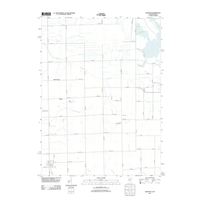
2012 Map of Donovan
USGS Topo · Published 2012About this map
Beaver Cr and its various tributaries, including Hooper Br and Blackston Br, define the drainage patterns of this rural landscape on the Illinois-Indiana border. The area is characterized by an extensive network of man-made waterways such as Beaver Ditch Number 1 and Baird Ditch, which support the agricultural utility of the land. Small clusters of activity are centered around Hooper and North Hooper, while aviation history is represented by Loy Airport and Russell Airport. Local genealogy is anchored by the Beaver Cem and J H Grant Memorial Cem, which sit amidst the grid of country roads. The map also captures the distinct boundary where the road numbering systems of Iroquois County, Illinois, meet the rural routes of Indiana, evidenced by the transition to names like S 700 W.
Find a feature on this map
66 named features on this map. Tap any name to fly to it.
Don’t see what you’re looking for? This feature index may not catch every label — zoom into the map to look around manually.
Map Details
Editions of this 2012 Donovan Map
This is the sole edition of this map. No revisions or reprints were ever made.
Other maps of this area

1922 · Momence
USGS Topo · 1:62,500

1924 · Momence
USGS Topo · 1:62,500

1935 · Watseka
USGS Topo · 1:48,000

1939 · Watseka
USGS Topo · 1:62,500

1953 · Chicago
USGS Topo · 1:250,000

1953 · Danville
USGS Topo · 1:250,000

1955 · Danville
USGS Topo · 1:250,000

1956 · Danville
USGS Topo · 1:250,000

1957 · Chicago
USGS Topo · 1:250,000

1961 · Kentland
USGS Topo · 1:24,000