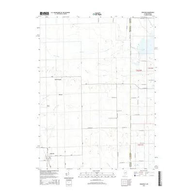
2015 Map of Donovan
USGS Topo · Published 2015About this map
Donovan and the surrounding borderlands of the Illinois-Indiana state line are defined by an extensive network of drainage channels that transformed the prairie for agriculture. The settlement of Donovan sits at the junction of N Raub St and North St, while further north, the community of North Hooper and the nearby Hooper Br reveal the rural development patterns of Iroquois County. This 2015 topography shows a landscape deeply engineered for water management, featuring a dense system of ditches such as Beaver Ditch Number 1 and Carlson Ditch.
Find a feature on this map
50 named features on this map. Tap any name to fly to it.
Don’t see what you’re looking for? This feature index may not catch every label — zoom into the map to look around manually.
Map Details
Editions of this 2015 Donovan Map
This is the sole edition of this map. No revisions or reprints were ever made.
Other maps of this area

1922 · Momence
USGS Topo · 1:62,500

1924 · Momence
USGS Topo · 1:62,500

1935 · Watseka
USGS Topo · 1:48,000

1939 · Watseka
USGS Topo · 1:62,500

1953 · Chicago
USGS Topo · 1:250,000

1953 · Danville
USGS Topo · 1:250,000

1955 · Danville
USGS Topo · 1:250,000

1956 · Danville
USGS Topo · 1:250,000

1957 · Chicago
USGS Topo · 1:250,000

1961 · Kentland
USGS Topo · 1:24,000