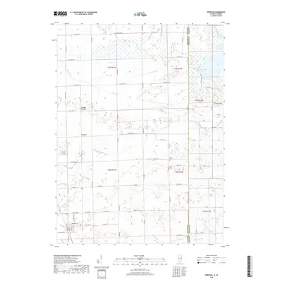
2018 Map of Donovan
USGS Topo · Published 2018About this map
Donovan anchors the southwestern portion of this landscape, situated at the intersection of local roads and a historic rail corridor. This territory along the Illinois and Indiana state line is defined by a complex network of managed waterways, including Beaver Ditch Number 1 and Carlson Ditch, which drain the low-lying prairie into larger channels like Beaver Creek. The map provides a detailed view of small rural clusters such as Hooper and North Hooper, alongside isolated family landmarks and burial sites like the J H Grant Memorial Cem and Beaver Cem. To the east, the terrain transitions into the wetland-rich areas of Newton Co Indiana, featuring J C Murphey Lake and Cory Lake. This 2018 survey reveals a modern agricultural landscape that still respects the early drainage engineering and township boundaries established generations prior.
Find a feature on this map
54 named features on this map. Tap any name to fly to it.
Don’t see what you’re looking for? This feature index may not catch every label — zoom into the map to look around manually.
Map Details
Editions of this 2018 Donovan Map
This is the sole edition of this map. No revisions or reprints were ever made.
Other maps of this area

1922 · Momence
USGS Topo · 1:62,500

1924 · Momence
USGS Topo · 1:62,500

1935 · Watseka
USGS Topo · 1:48,000

1939 · Watseka
USGS Topo · 1:62,500

1953 · Chicago
USGS Topo · 1:250,000

1953 · Danville
USGS Topo · 1:250,000

1955 · Danville
USGS Topo · 1:250,000

1956 · Danville
USGS Topo · 1:250,000

1957 · Chicago
USGS Topo · 1:250,000

1961 · Kentland
USGS Topo · 1:24,000