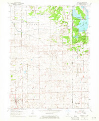
1964 Map of Donovan
USGS Topo · Published 1965About this map
Donovan and its surrounding prairie landscapes are defined by an intricate network of drainage ditches and the dual presence of major railroads in the mid-1960s. The Chicago Milwaukee St Paul and Pacific and New York Central lines intersect at Donovan, signaling the town's role as a transit hub for agricultural goods. To the east, the state line between Illinois and Indiana cuts through a large wetland complex centered on Willow Slough and J C Murphy Lake, which sit within the State Game Preserve. This transition from the orderly grid of the Beaver and Washington townships to the protected wilder reaches of the Indiana wetlands is starkly visible. Local history is anchored by rural landmarks like Beaver Ch and Beaver Cem, while vanished stopovers like Hooper and North Hooper indicate the shifting settlement patterns of Iroquois County.
Find a feature on this map
33 named features on this map. Tap any name to fly to it.
Don’t see what you’re looking for? This feature index may not catch every label — zoom into the map to look around manually.
Map Details
Editions of this 1964 Donovan Map
This is the sole edition of this map. No revisions or reprints were ever made.
Other maps of this area

1922 · Momence
USGS Topo · 1:62,500

1924 · Momence
USGS Topo · 1:62,500

1935 · Watseka
USGS Topo · 1:48,000

1939 · Watseka
USGS Topo · 1:62,500

1953 · Chicago
USGS Topo · 1:250,000

1953 · Danville
USGS Topo · 1:250,000

1955 · Danville
USGS Topo · 1:250,000

1956 · Danville
USGS Topo · 1:250,000

1957 · Chicago
USGS Topo · 1:250,000

1961 · Kentland
USGS Topo · 1:24,000