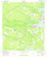
1958 Map of Dorchester
USGS Topo · Published 1976About this map
Midway and Dorchester anchor this coastal Georgia landscape, where the Seaboard Coast Line Railroad and historical routes like the Sunbury Road cut through an extensive network of wetlands. The map reveals a geography dominated by the massive Baker Swamp, Russell Swamp, and Peacock Creek, which dictated the placement of early settlements and agricultural experiments. The presence of the Tidewater Experimental Station and the Dorchester Cooperative Center highlights the region's focus on land management and rural development during the mid-20th century.
Find a feature on this map
36 named features on this map. Tap any name to fly to it.
Don’t see what you’re looking for? This feature index may not catch every label — zoom into the map to look around manually.
Map Details
Editions of this 1958 Dorchester Map
3 editions found
Other maps of this area

1918 · Hinesville
USGS Topo · 1:62,500

1920 · Sapelo River
USGS Topo · 1:62,500

1920 · Limerick
USGS Topo · 1:62,500

1943 · Ludowici
USGS Topo · 1:62,500

1943 · Sapelo River
USGS Topo · 1:62,500

1944 · Hinesville
USGS Topo · 1:62,500

1944 · Limerick
USGS Topo · 1:62,500

1945 · Sapelo River
USGS Topo · 1:62,500

1946 · Brunswick
USGS Topo · 1:250,000

1948 · Brunswick
USGS Topo · 1:250,000