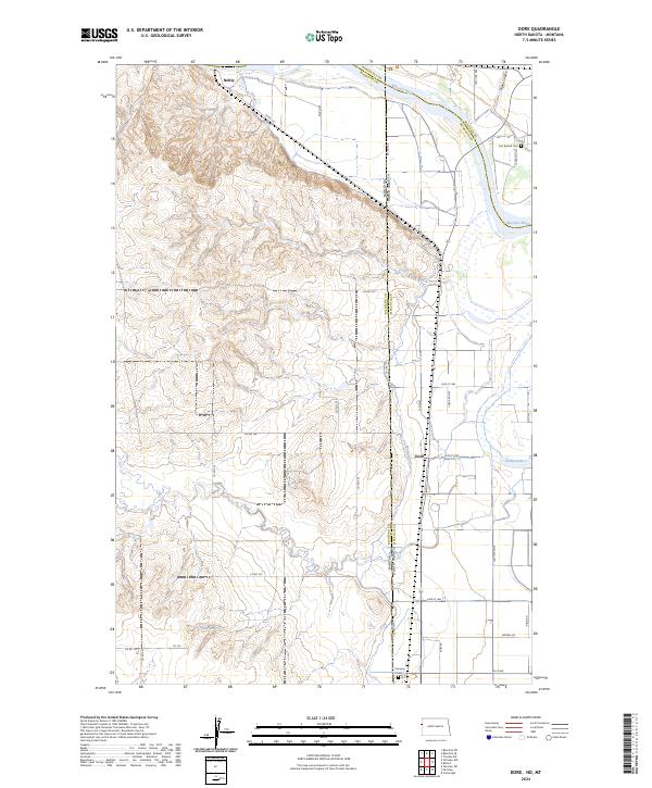
2024 Map of Dore
USGS Topo · Published 2024About this map
The Fort Union Trading Post National Historic Site stands as a focal point along the northern bank of the Missouri River, marking the intersection of Richland and Roosevelt counties at the state line. This landscape is defined by the sharp transition from the dissected uplands in the west to the fertile river valley floor. The settlement of Nohly sits near the river's edge, while Dore is positioned further south along the Main Canal, reflecting the importance of water management in this agricultural region. Genealogists and local historians can locate the Fort Buford Cem in the northeast and the Fairview Cem near the southern border. The map also detailes natural features like Nohly Lake and Simon Spring, alongside the rugged drainage of Figley Coulee.
Find a feature on this map
40 named features on this map. Tap any name to fly to it.
Don’t see what you’re looking for? This feature index may not catch every label — zoom into the map to look around manually.
Map Details
Editions of this 2024 Dore Map
This is the sole edition of this map. No revisions or reprints were ever made.
Other maps of this area

1909 · Glendive
USGS Topo · 1:250,000

1953 · Williston
USGS Topo · 1:250,000

1953 · Watford City
USGS Topo · 1:250,000

1954 · Glendive
USGS Topo · 1:250,000

1954 · Wolf Point
USGS Topo · 1:250,000

1957 · Glendive
USGS Topo · 1:250,000

1957 · Williston
USGS Topo · 1:250,000

1957 · Watford City
USGS Topo · 1:250,000

1958 · Wolf Point
USGS Topo · 1:250,000

1958 · Glendive
USGS Topo · 1:250,000