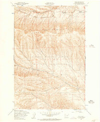
1953 Map of Doris
USGS Topo · Published 1957About this map
The Saddle Mountains define the northern landscape of this mid-century Kittitas County survey, where the Chicago Milwaukee St Paul and Pacific railroad follows the natural corridor of Johnson Creek. Small rail stops like Doris and Rye mark the line, serving as isolated points of activity before the track bends away from the high ridgelines. Most of the southern half of the quadrangle is occupied by the Yakima Firing Center Military Reservation, reflecting the Cold War era's significant military footprint in the Washington interior.
Find a feature on this map
9 named features on this map. Tap any name to fly to it.
Don’t see what you’re looking for? This feature index may not catch every label — zoom into the map to look around manually.
Map Details
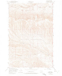
Editions of this 1953 Doris Map
2 editions found
Other maps of this area

1912 · Beverly
USGS Topo · 1:62,500

1917 · Priest Rapids
USGS Topo · 1:62,500

1936 · Hog Ranch Buttes
USGS Topo · 1:48,000

1939 · Boylston
USGS Topo · 1:48,000

1941 · Black Rock Spring
USGS Topo · 1:62,500

1943 · Boylston
USGS Topo · 1:62,500

1948 · Priest Rapids
USGS Topo · 1:24,000

1950 · Yakima
USGS Topo · 1:250,000

1951 · Priest Rapids
USGS Topo · 1:62,500

1953 · McDonald Spring
USGS Topo · 1:24,000