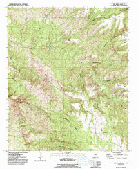
1992 Map of Dorsey Ranch
USGS Topo · Published 1992About this map
Hells Half Acre dominates the central landscape of this territory within the Gila National Forest, where steep canyon walls and isolated mesas define the topography. The map illustrates a high-desert environment managed for ranching and resource extraction, anchored by the Dorsey Ranch and the nearby H W Ranch. Water sources are critical points of interest in this arid terrain, marked by scattered locations like Lee Spring, Seep Springs, and the Dorsey Hole Spring.
Find a feature on this map
38 named features on this map. Tap any name to fly to it.
Don’t see what you’re looking for? This feature index may not catch every label — zoom into the map to look around manually.
Map Details
Editions of this 1992 Dorsey Ranch Map
This is the sole edition of this map. No revisions or reprints were ever made.
Other maps of this area

1909 · Silver City
USGS Topo · 1:125,000

1910 · Mogollon
USGS Topo · 1:125,000

1911 · Alum Mountain
USGS Topo · 1:125,000

1912 · Mogollon
USGS Topo · 1:125,000

1913 · Alum Mountain
USGS Topo · 1:125,000

1949 · Circle Mesa
USGS Topo · 1:24,000

1950 · Dorsey Ranch
USGS Topo · 1:24,000

1950 · Silver City
USGS Topo · 1:24,000

1950 · Reading Mountain
USGS Topo · 1:24,000

1951 · Circle Mesa
USGS Topo · 1:24,000