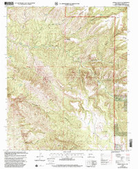
1999 Map of Dorsey Ranch
USGS Topo · Published 2002About this map
Dorsey Ranch and the rugged canyonlands of the Silver City Ranger District define this high-altitude landscape within the Gila National Forest. This mapping, updated at the close of the millennium, illustrates a network of cattle-raising outposts and remote water sources including Dorsey Hole Spring and Lee Spring. The terrain is characterized by massive flat-topped features such as Reading Mesa and Buckwood Mesa, which are dissected by complex drainages like Greenwood Canyon and Blacksmith Canyon. The presence of several grazing-related locations, such as Dorsey Camp and H W Ranch, alongside Gravel Pits in the southern sector, points to a landscape balancing forest management with local ranching and extraction. Notably, the map captures the transition between the high mesa tops and deep valley cuts like First Valley, offering a precise record of the road and 4WD trail network used by ranchers and foresters alike.
Find a feature on this map
41 named features on this map. Tap any name to fly to it.
Don’t see what you’re looking for? This feature index may not catch every label — zoom into the map to look around manually.
Map Details
Editions of this 1999 Dorsey Ranch Map
This is the sole edition of this map. No revisions or reprints were ever made.
Other maps of this area

1909 · Silver City
USGS Topo · 1:125,000

1910 · Mogollon
USGS Topo · 1:125,000

1911 · Alum Mountain
USGS Topo · 1:125,000

1912 · Mogollon
USGS Topo · 1:125,000

1913 · Alum Mountain
USGS Topo · 1:125,000

1949 · Circle Mesa
USGS Topo · 1:24,000

1950 · Dorsey Ranch
USGS Topo · 1:24,000

1950 · Silver City
USGS Topo · 1:24,000

1950 · Reading Mountain
USGS Topo · 1:24,000

1951 · Circle Mesa
USGS Topo · 1:24,000