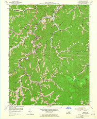
1954 Map of Dorton
USGS Topo · Published 1965About this map
Shelby and Caney Creek define the drainage and settlement patterns of this central Appalachian landscape in the mid-1950s. The Chesapeake and Ohio railroad tracks tightly follow the winding valley of Shelby Creek, connecting coal-era hamlets like Penny, Myra, and Jonancy. The map reveals a highly localized social geography, with numerous small schools and churches serving individual hollows, such as Esco Sch and Jones Chapel.
Find a feature on this map
45 named features on this map. Tap any name to fly to it.
Don’t see what you’re looking for? This feature index may not catch every label — zoom into the map to look around manually.
Map Details
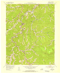
Editions of this 1954 Dorton Map
3 editions found

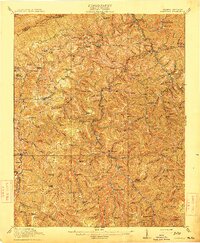
Other maps of this area

1886 · Grundy
USGS Topo · 1:125,000

1890 · Whitesburg
USGS Topo · 1:125,000

1890 · Grundy
USGS Topo · 1:125,000

1892 · Grundy
USGS Topo · 1:125,000

1892 · Whitesburg
USGS Topo · 1:125,000

1912 · Pound
USGS Topo · 1:48,000

1913 · Clintwood
USGS Topo · 1:62,500

1914 · Pound
USGS Topo · 1:62,500

1914 · Vergie
USGS Topo · 1:48,000
1915 · Clintwood
USGS Topo · 1:62,500