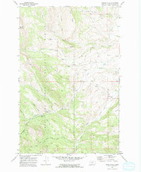
1970 Map of Double Falls
USGS Topo · Published 1973About this map
Lewis and Clark National Forest encompasses the vast majority of this landscape, dominated by the peaks of Fairview Mountain and Crown Mountain. The area is defined by a dense network of pack trails, including the Fairview Trail, Ford Creek Trail, and Petty Creek Trail, which navigate the steep drainages of Willow Creek and Ford Creek. These paths historically provided access to remote outposts such as the Fish and Game Cabin and Willow Creek Cabin, alongside seasonal livestock operations.
Find a feature on this map
33 named features on this map. Tap any name to fly to it.
Don’t see what you’re looking for? This feature index may not catch every label — zoom into the map to look around manually.
Map Details
Editions of this 1970 Double Falls Map
2 editions found
Other maps of this area

1903 · Saypo
USGS Topo · 1:125,000

1903 · Coopers Lake
USGS Topo · 1:125,000

1955 · Choteau
USGS Topo · 1:250,000

1957 · Choteau
USGS Topo · 1:250,000

1958 · Choteau
USGS Topo · 1:250,000

1958 · Barr Creek
USGS Topo · 1:24,000

1958 · Sawtooth Ridge
USGS Topo · 1:24,000

1958 · Patricks Basin
USGS Topo · 1:24,000

1962 · Choteau
USGS Topo · 1:250,000
1970 · Scapegoat Mountain
USGS Topo · 1:24,000