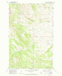
1970 Map of Double Falls
USGS Topo · Published 1973About this map
Lewis and Clark National Forest encompasses this wilderness area where the mountain ridges of Lime Ridge and Fairview Mountain overlook a network of creek drainages. The landscape is defined by the confluence of North Fork Sun River, Willow Creek, and Smith Creek, providing a haven for remote outposts and ranching operations. Human presence is marked by isolated structures such as the Hidden Valley Ranch, Scoutana Ranch, and the Fish and Game Cabin, indicating the area's use for both private ranching and public wildlife management. Travel through this terrain relied on a system of pack trails and jeep trails, reflecting the limited accessibility of the region during the early 1970s. The presence of Double Falls and numerous springs suggests a landscape where water and topography dictated the placement of early cabins and livestock crossings like Petty Ford Creek.
Find a feature on this map
29 named features on this map. Tap any name to fly to it.
Don’t see what you’re looking for? This feature index may not catch every label — zoom into the map to look around manually.
Map Details
Editions of this 1970 Double Falls Map
2 editions found
Other maps of this area

1903 · Saypo
USGS Topo · 1:125,000

1903 · Coopers Lake
USGS Topo · 1:125,000

1955 · Choteau
USGS Topo · 1:250,000

1957 · Choteau
USGS Topo · 1:250,000

1958 · Choteau
USGS Topo · 1:250,000

1958 · Barr Creek
USGS Topo · 1:24,000

1958 · Sawtooth Ridge
USGS Topo · 1:24,000

1958 · Patricks Basin
USGS Topo · 1:24,000

1962 · Choteau
USGS Topo · 1:250,000
1970 · Scapegoat Mountain
USGS Topo · 1:24,000