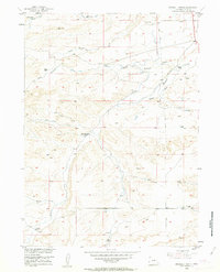
1953 Map of Double L Ranch
USGS Topo · Published 1963About this map
The Richeau Hills define the topography of this Platte County landscape, where water rights and ranch boundaries shaped the local economy in the early 1950s. The drainage system of Richeau Creek and its many tributaries, including North Richeau Creek and Scotch Creek, provides a framework for the established homesteads of the era. These family-named properties, such as the Double L Ranch, Allison Ranch, and Grant Ranch, are connected by primitive roads and a network of water management features like the Walker Draw and a notable Aban Ditch. The map illustrates a transitional period of development in the Missouri River Basin, documenting the presence of a Pipe Line alongside traditional landmarks like VABM 5590 Hunton and Beacon No 8.
Find a feature on this map
26 named features on this map. Tap any name to fly to it.
Don’t see what you’re looking for? This feature index may not catch every label — zoom into the map to look around manually.
Map Details
Editions of this 1953 Double L Ranch Map
3 editions found
Other maps of this area

1953 · Double L Ranch
USGS Topo · 1:24,000

1953 · Chugwater
USGS Topo · 1:24,000

1953 · Natwick
USGS Topo · 1:24,000

1953 · Ferguson Corner
USGS Topo · 1:24,000

1953 · Bordeaux
USGS Topo · 1:24,000

1953 · Richeau Hills
USGS Topo · 1:24,000

1954 · Cheyenne
USGS Topo · 1:250,000

1958 · Cheyenne
USGS Topo · 1:250,000

1962 · Mc Donald Ranch
USGS Topo · 1:24,000

1962 · Bristol Ridge NE
USGS Topo · 1:24,000