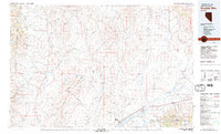
1981 Map of Double Mtn
USGS Topo · Published 1982About this map
The Adobe Range and the eastern flanks of the Independence Mountains dominate this high-desert landscape in northeastern Nevada. During the early 1980s, this region remained a vital transportation corridor where the Southern Pacific and Western Pacific railroads parallel the Humboldt River. The map documents the spatial relationship between these historic rail lines and the evolution of Interstate 80, which traces the older path of U S Highway 40 through the valley.
Find a feature on this map
57 named features on this map. Tap any name to fly to it.
Don’t see what you’re looking for? This feature index may not catch every label — zoom into the map to look around manually.
Map Details
Editions of this 1981 Double Mtn Map
2 editions found
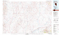
Other maps of this area

1935 · Halleck
USGS Topo · 1:125,000

1935 · Charleston
USGS Topo · 1:48,000

1942 · Mt. Velma
USGS Topo · 1:62,500

1955 · McDermitt
USGS Topo · 1:250,000

1955 · Wells
USGS Topo · 1:250,000

1955 · Winnemucca
USGS Topo · 1:250,000

1955 · Elko
USGS Topo · 1:250,000

1956 · Tuscarora
USGS Topo · 1:62,500

1956 · Bull Run
USGS Topo · 1:62,500

1956 · Wild Horse
USGS Topo · 1:62,500