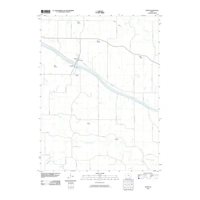
2010 Map of Douds
USGS Topo · Published 2010About this map
The Des Moines River cuts diagonally through this Van Buren County landscape, defining the twin settlements of Douds and Leando on opposite banks. These communities are linked by bridge and historical proximity, with the Douds Post Office serving as a central landmark. The surrounding rural townships are dotted with several small burial grounds that reflect the area's early family settlement patterns, including the Boyer Family Cemetery, Leando Cemetery, and the more distant White Chapel Cemetery.
Find a feature on this map
46 named features on this map. Tap any name to fly to it.
Don’t see what you’re looking for? This feature index may not catch every label — zoom into the map to look around manually.
Map Details
Editions of this 2010 Douds Map
This is the sole edition of this map. No revisions or reprints were ever made.
Other maps of this area

1954 · Centerville
USGS Topo · 1:250,000

1957 · Centerville
USGS Topo · 1:250,000

1958 · Centerville
USGS Topo · 1:250,000

1958 · Burlington
USGS Topo · 1:250,000

1961 · Burlington
USGS Topo · 1:250,000

1963 · Burlington
USGS Topo · 1:250,000
1965 · Eldon
USGS Topo · 1:24,000

1965 · Selma
USGS Topo · 1:24,000
1965 · Libertyville
USGS Topo · 1:24,000

1965 · Douds
USGS Topo · 1:24,000