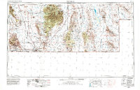
1959 Map of Douglas
USGS Topo · Published 1982About this map
Douglas and Bisbee anchor this 1970 revision of the Arizona-New Mexico borderlands, where the copper industry and international trade define the landscape. The Mule Mountains surround the mining complex of Warren, Lowell, and Bakerville, with the Smelter and Bisbee Junction reflecting the era's heavy industrial footprint. To the east, the Chiricahua Mountains dominate the horizon, protected within the Coronado National Forest and Chiricahua National Monument.
Find a feature on this map
55 named features on this map. Tap any name to fly to it.
Don’t see what you’re looking for? This feature index may not catch every label — zoom into the map to look around manually.
Map Details
Editions of this 1959 Douglas Map
4 editions found

Other maps of this area

1899 · Deming
USGS Topo · 1:125,000

1902 · Bisbee
USGS Topo · 1:62,500

1910 · Bisbee
USGS Topo · 1:62,500

1914 · Hereford
USGS Topo · 1:125,000

1914 · Douglas
USGS Topo · 1:62,500

1915 · Benson
USGS Topo · 1:125,000

1915 · Deming
USGS Topo · 1:125,000

1916 · Pearce
USGS Topo · 1:125,000

1916 · Douglas
USGS Topo · 1:125,000

1917 · Hermanas
USGS Topo · 1:62,500