
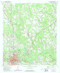
1971 Map of Douglas North
USGS Topo · Published 1974About this map
Douglas serves as the hub of this Georgia survey, positioned where the Central of Georgia and Seaboard Coast Line railroads meet. The landscape north of the city is defined by the winding course of the Seventeen Mile River and its various tributaries, including Twenty Mile Creek and Tiger Creek. In this era, rural life is marked by numerous country churches and schools that served the surrounding agricultural land, such as Oak Grove Ch, Mt Calvary Ch, and Central Sch.
Find a feature on this map
48 named features on this map. Tap any name to fly to it.
Don’t see what you’re looking for? This feature index may not catch every label — zoom into the map to look around manually.
Map Details
Editions of this 1971 Douglas North Map
2 editions found
Other maps of this area

1953 · Waycross
USGS Topo · 1:250,000

1958 · Waycross
USGS Topo · 1:250,000

1971 · Douglas South
USGS Topo · 1:24,000

1971 · Nicholls
USGS Topo · 1:24,000

1971 · Wilsonville
USGS Topo · 1:24,000

1971 · Broxton NE
USGS Topo · 1:24,000

1971 · Denton
USGS Topo · 1:24,000

1972 · Broxton North
USGS Topo · 1:24,000

1972 · Mora
USGS Topo · 1:24,000
1977 · Mora
USGS Topo · 1:24,000