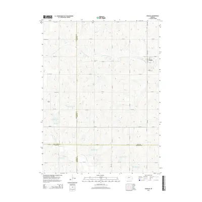
2014 Map of Douglas
USGS Topo · Published 2014About this map
The village of Douglas sits at the intersection of Washington St and W 6th St in Otoe County, serving as a primary hub for this agricultural landscape. The surrounding terrain is defined by the drainage basins of the S Fork Little Nemaha River and the N Fork Big Nemaha River. Local history is anchored by several rural burial grounds, including Solon Cem and Saint Martins Cem, which provide essential points of reference for genealogists tracing early families in the region.
Find a feature on this map
48 named features on this map. Tap any name to fly to it.
Don’t see what you’re looking for? This feature index may not catch every label — zoom into the map to look around manually.
Map Details
Editions of this 2014 Douglas Map
This is the sole edition of this map. No revisions or reprints were ever made.
Other maps of this area

1897 · Lincoln
USGS Topo · 1:125,000

1903 · Weeping Water
USGS Topo · 1:125,000

1929 · Weeping Water
USGS Topo · 1:125,000

1955 · Lincoln
USGS Topo · 1:250,000

1957 · Lincoln
USGS Topo · 1:250,000

1958 · Lincoln
USGS Topo · 1:250,000

1965 · Adams
USGS Topo · 1:24,000

1965 · Sterling
USGS Topo · 1:24,000
1965 · Firth
USGS Topo · 1:24,000
1965 · Douglas
USGS Topo · 1:24,000