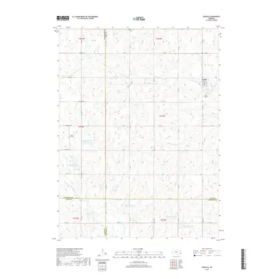
2017 Map of Douglas
USGS Topo · Published 2017About this map
Agricultural patterns and water management systems define this section of Otoe County, centered on the village of Douglas. The landscape is etched by the S Fork Little Nemaha River in the north and the N Fork Big Nemaha River to the south, with numerous flood control structures such as Upper Big Nemaha Reservoir L-10 and Upper Big Nemaha Reservoir 20-B protecting the surrounding farmland. These reservoirs reflect modern land use strategies in the Great Plains, where managed drainage is critical to the local economy.
Find a feature on this map
56 named features on this map. Tap any name to fly to it.
Don’t see what you’re looking for? This feature index may not catch every label — zoom into the map to look around manually.
Map Details
Editions of this 2017 Douglas Map
This is the sole edition of this map. No revisions or reprints were ever made.
Other maps of this area

1897 · Lincoln
USGS Topo · 1:125,000

1903 · Weeping Water
USGS Topo · 1:125,000

1929 · Weeping Water
USGS Topo · 1:125,000

1955 · Lincoln
USGS Topo · 1:250,000

1957 · Lincoln
USGS Topo · 1:250,000

1958 · Lincoln
USGS Topo · 1:250,000

1965 · Adams
USGS Topo · 1:24,000

1965 · Sterling
USGS Topo · 1:24,000
1965 · Firth
USGS Topo · 1:24,000
1965 · Douglas
USGS Topo · 1:24,000