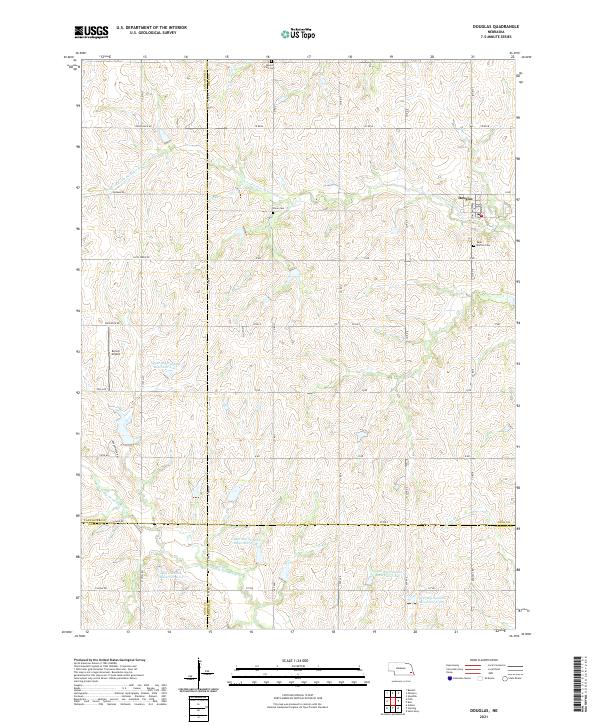
2021 Map of Douglas
USGS Topo · Published 2021About this map
The community of Douglas sits at the intersection of Washington St and Main St, serving as a central hub in this agricultural landscape where Otoe, Lancaster, Gage, and Johnson Counties meet. The terrain is defined by the branching waterways of the S Fork Little Nemaha River and the N Fork Big Nemaha River, which are managed through a series of water control structures including Upper Big Nemaha Reservoir L-10 and Big Nemaha Reservoir G-15. These reservoirs and small tributaries like Pratts Br highlight the sophisticated drainage and water management systems essential to the region's farming economy. Local heritage is anchored by sites such as Saint Martins Cem and Solon Cem, while the inclusion of Korver Airport reflects the continued integration of private aviation into the rural Nebraska infrastructure.
Find a feature on this map
56 named features on this map. Tap any name to fly to it.
Don’t see what you’re looking for? This feature index may not catch every label — zoom into the map to look around manually.
Map Details
Editions of this 2021 Douglas Map
This is the sole edition of this map. No revisions or reprints were ever made.
Other maps of this area

1897 · Lincoln
USGS Topo · 1:125,000

1903 · Weeping Water
USGS Topo · 1:125,000

1929 · Weeping Water
USGS Topo · 1:125,000

1955 · Lincoln
USGS Topo · 1:250,000

1957 · Lincoln
USGS Topo · 1:250,000

1958 · Lincoln
USGS Topo · 1:250,000

1965 · Adams
USGS Topo · 1:24,000

1965 · Sterling
USGS Topo · 1:24,000
1965 · Firth
USGS Topo · 1:24,000
1965 · Douglas
USGS Topo · 1:24,000