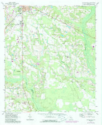
1971 Map of Douglas South
USGS Topo · Published 1987About this map
The city of Douglas anchors the northern reaches of this Georgia landscape, featuring the sprawling grounds of South Georgia College and the Douglas Municipal Airport. As the terrain transitions south, the map reveals a rural network of small family and community landmarks, including Morman Cem and Mc Clelland Cem. The geography is defined by a distinct drainage system where the Satilla River meets the Indefinite Boundary at the border of Coffee and Atkinson County.
Find a feature on this map
27 named features on this map. Tap any name to fly to it.
Don’t see what you’re looking for? This feature index may not catch every label — zoom into the map to look around manually.
Map Details
Editions of this 1971 Douglas South Map
2 editions found
Other maps of this area

1953 · Waycross
USGS Topo · 1:250,000

1958 · Waycross
USGS Topo · 1:250,000

1971 · Douglas North
USGS Topo · 1:24,000

1971 · Douglas South
USGS Topo · 1:24,000

1971 · Nicholls
USGS Topo · 1:24,000

1971 · Wilsonville
USGS Topo · 1:24,000

1971 · Axson
USGS Topo · 1:24,000

1971 · Pearson
USGS Topo · 1:24,000

1972 · Kirkland
USGS Topo · 1:24,000

1972 · Mora
USGS Topo · 1:24,000