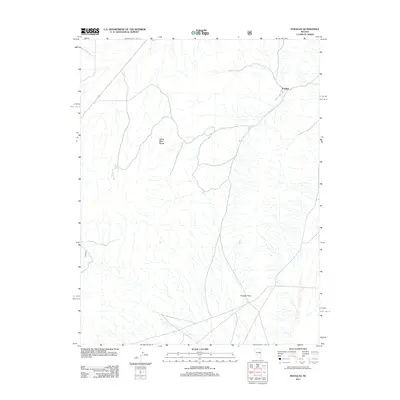
2012 Map of Douglas
USGS Topo · Published 2012About this map
Douglas stands as the primary namesake settlement in this high-elevation landscape of eastern Nevada. The terrain is dominated by the sprawling north-south orientation of the White River Range, a major mountain feature that influences the drainage patterns across the quadrangle. Water sources are scarce in this arid environment, making features like Granite Spring critical points of interest for historical land use and travel. To the south, Douglas Point provides a significant landmark within the broken topography. The map illustrates a network of mountain roads and tracks that connect these isolated points, reflecting the region's sparse development and its reliance on specific natural features for navigation and settlement in the early 21st century.
Find a feature on this map
4 named features on this map. Tap any name to fly to it.
Don’t see what you’re looking for? This feature index may not catch every label — zoom into the map to look around manually.
Map Details
Editions of this 2012 Douglas Map
This is the sole edition of this map. No revisions or reprints were ever made.
Other maps of this area

1956 · Lund
USGS Topo · 1:250,000

1957 · Currant Mtn
USGS Topo · 1:62,500

1960 · Lund
USGS Topo · 1:250,000

1964 · Currant
USGS Topo · 1:62,500

1964 · Currant Mtn
USGS Topo · 1:62,500

1969 · Moorman Spring NW
USGS Topo · 1:24,000

1969 · Moorman Spring NE
USGS Topo · 1:24,000
1978 · Lund
USGS Topo · 1:24,000
1978 · Douglas
USGS Topo · 1:24,000
1978 · Badger Hole Spring
USGS Topo · 1:24,000