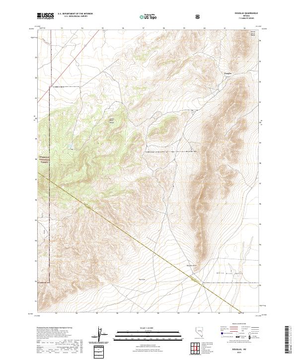
2021 Map of Douglas
USGS Topo · Published 2021About this map
White River Range terrain dominates this high-elevation landscape, where the administrative boundary between White Pine and Nye counties cuts across the southeastern corner. The map captures a largely undisturbed environment within the Humboldt National Forest, characterized by steep drainage patterns and high ridges. The settlement of Douglas serves as the primary named point of interest in the northeast, positioned where the hills descend toward the expansive White River Valley.
Find a feature on this map
15 named features on this map. Tap any name to fly to it.
Don’t see what you’re looking for? This feature index may not catch every label — zoom into the map to look around manually.
Map Details
Editions of this 2021 Douglas Map
This is the sole edition of this map. No revisions or reprints were ever made.
Other maps of this area

1956 · Lund
USGS Topo · 1:250,000

1957 · Currant Mtn
USGS Topo · 1:62,500

1960 · Lund
USGS Topo · 1:250,000

1964 · Currant
USGS Topo · 1:62,500

1964 · Currant Mtn
USGS Topo · 1:62,500

1969 · Moorman Spring NW
USGS Topo · 1:24,000

1969 · Moorman Spring NE
USGS Topo · 1:24,000
1978 · Lund
USGS Topo · 1:24,000
1978 · Douglas
USGS Topo · 1:24,000
1978 · Badger Hole Spring
USGS Topo · 1:24,000