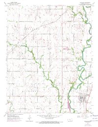
1955 Map of Douglass
USGS Topo · Published 1971About this map
Douglass serves as the primary hub in this mid-century survey of southern Butler County, situated where the Walnut River and Little Walnut River converge. The landscape is defined by the agricultural and extractive patterns of the Kansas plains, with the Atchison Topeka and Santa Fe railroad cutting diagonally through the townships of Pleasant and Richland. Numerous oil wells and gravel pits scattered across the terrain indicate a local economy driven by more than just farming.
Find a feature on this map
26 named features on this map. Tap any name to fly to it.
Don’t see what you’re looking for? This feature index may not catch every label — zoom into the map to look around manually.
Map Details
Editions of this 1955 Douglass Map
4 editions found

Other maps of this area

1888 · Eldorado
USGS Topo · 1:125,000

1889 · Burden
USGS Topo · 1:125,000

1889 · Wichita
USGS Topo · 1:125,000

1890 · Wellington
USGS Topo · 1:125,000

1894 · Wichita
USGS Topo · 1:125,000

1945 · Andover
USGS Topo · 1:31,680

1955 · Udall
USGS Topo · 1:24,000

1955 · Santa Fe Lake
USGS Topo · 1:24,000

1955 · Rose Hill
USGS Topo · 1:24,000

1955 · Mulvane
USGS Topo · 1:24,000