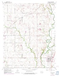
1955 Map of Douglass
USGS Topo · Published 1983About this map
Douglass serves as the primary hub of activity in this 1955 survey, situated at the confluence of the Walnut River and the Little Walnut River. The map captures a landscape defined by its agricultural layout and early-to-mid-century energy infrastructure, evidenced by numerous Oil Wells and Oil Well sites scattered across the river bottoms. Local heritage is deeply rooted in its rural institutions, including the Floral Sch, Richland Sch, and Friends Ch, alongside several family and community burial grounds like Dunlap Cem and Friends Cem. The Atchison Topeka and Santa Fe railroad runs north-south through the valley, anchoring the local economy. Changes noted in the early 1980s include a specialized Landing Strip and modern industrial features like a Substation, showing the gradual evolution of this Butler County landscape from its mid-century roots.
Find a feature on this map
27 named features on this map. Tap any name to fly to it.
Don’t see what you’re looking for? This feature index may not catch every label — zoom into the map to look around manually.
Map Details
Editions of this 1955 Douglass Map
4 editions found

Other maps of this area

1888 · Eldorado
USGS Topo · 1:125,000

1889 · Burden
USGS Topo · 1:125,000

1889 · Wichita
USGS Topo · 1:125,000

1890 · Wellington
USGS Topo · 1:125,000

1894 · Wichita
USGS Topo · 1:125,000

1945 · Andover
USGS Topo · 1:31,680

1955 · Udall
USGS Topo · 1:24,000

1955 · Santa Fe Lake
USGS Topo · 1:24,000

1955 · Rose Hill
USGS Topo · 1:24,000

1955 · Mulvane
USGS Topo · 1:24,000