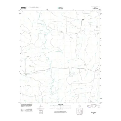
2010 Map of Douglass
USGS Topo · Published 2010About this map
The Angelina River meanders through this East Texas landscape, creating a complex network of oxbows and wetlands including Horseshoe Lake, Duck Roost Lake, and Clear Lake. This river system forms a natural boundary and geographical focal point for the surrounding rural communities. The map detail highlights the intricate drainage patterns of tributaries like Gibbons Creek and King Creek as they feed into the river valley.
Find a feature on this map
60 named features on this map. Tap any name to fly to it.
Don’t see what you’re looking for? This feature index may not catch every label — zoom into the map to look around manually.
Map Details
Editions of this 2010 Douglass Map
This is the sole edition of this map. No revisions or reprints were ever made.
Other maps of this area

1943 · Cushing
USGS Topo · 1:62,500

1943 · Rusk
USGS Topo · 1:62,500

1945 · Cushing
USGS Topo · 1:62,500

1945 · Rusk
USGS Topo · 1:62,500

1946 · Alto
USGS Topo · 1:62,500

1952 · Douglass
USGS Topo · 1:62,500

1953 · Palestine
USGS Topo · 1:250,000

1957 · Palestine
USGS Topo · 1:250,000

1973 · Cushing
USGS Topo · 1:24,000
1973 · Atoy
USGS Topo · 1:24,000