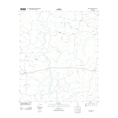
2013 Map of Douglass
USGS Topo · Published 2013About this map
The Angelina River meanders through a landscape of dense tributaries and bottomland lakes, defining the western reach of this survey. This riverine environment is characterized by distinctive water bodies such as Duck Roost Lake, Blue Lake, and Horseshoe Lake, which suggest a floodplain subject to shifting channels. The settlement of Douglass serves as a local anchor in the southeast, while the historic communities of Linwood and Lilbert mark the western and northern corridors.
Find a feature on this map
62 named features on this map. Tap any name to fly to it.
Don’t see what you’re looking for? This feature index may not catch every label — zoom into the map to look around manually.
Map Details
Editions of this 2013 Douglass Map
This is the sole edition of this map. No revisions or reprints were ever made.
Other maps of this area

1943 · Cushing
USGS Topo · 1:62,500

1943 · Rusk
USGS Topo · 1:62,500

1945 · Cushing
USGS Topo · 1:62,500

1945 · Rusk
USGS Topo · 1:62,500

1946 · Alto
USGS Topo · 1:62,500

1952 · Douglass
USGS Topo · 1:62,500

1953 · Palestine
USGS Topo · 1:250,000

1957 · Palestine
USGS Topo · 1:250,000

1973 · Cushing
USGS Topo · 1:24,000
1973 · Atoy
USGS Topo · 1:24,000