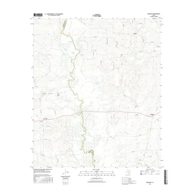
2016 Map of Douglass
USGS Topo · Published 2016About this map
The Angelina River carves a complex, winding path through this region, forming the natural border between Cherokee and Nacogdoches counties. This landscape is defined by the river’s hydrological influence, evidenced by a dense network of oxbow lakes and wetlands including Blue Lake, Horseshoe Lake, and Duck Roost Lake. These water bodies, along with Duck Roost Slough, indicate a flood-prone bottomland environment that has dictated local settlement patterns away from the immediate riverbanks.
Find a feature on this map
66 named features on this map. Tap any name to fly to it.
Don’t see what you’re looking for? This feature index may not catch every label — zoom into the map to look around manually.
Map Details
Editions of this 2016 Douglass Map
This is the sole edition of this map. No revisions or reprints were ever made.
Other maps of this area

1943 · Cushing
USGS Topo · 1:62,500

1943 · Rusk
USGS Topo · 1:62,500

1945 · Cushing
USGS Topo · 1:62,500

1945 · Rusk
USGS Topo · 1:62,500

1946 · Alto
USGS Topo · 1:62,500

1952 · Douglass
USGS Topo · 1:62,500

1953 · Palestine
USGS Topo · 1:250,000

1957 · Palestine
USGS Topo · 1:250,000

1973 · Cushing
USGS Topo · 1:24,000
1973 · Atoy
USGS Topo · 1:24,000