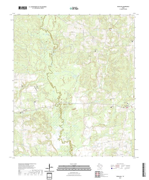
2022 Map of Douglass
USGS Topo · Published 2022About this map
The Angelina River and its intricate system of oxbow lakes, including Horseshoe Lake and Duck Roost Lake, define the western edge of this territory along the border of Cherokee and Nacogdoches counties. This riparian corridor is marked by extensive wetlands and sloughs like Duck Roost Slough, which stand in contrast to the agricultural and timber lands found further inland. Small rural settlements such as Douglass and Linwood serve as local anchors, connected by a network of farm-to-market roads and county routes.
Find a feature on this map
72 named features on this map. Tap any name to fly to it.
Don’t see what you’re looking for? This feature index may not catch every label — zoom into the map to look around manually.
Map Details
Editions of this 2022 Douglass Map
This is the sole edition of this map. No revisions or reprints were ever made.
Other maps of this area

1943 · Cushing
USGS Topo · 1:62,500

1943 · Rusk
USGS Topo · 1:62,500

1945 · Cushing
USGS Topo · 1:62,500

1945 · Rusk
USGS Topo · 1:62,500

1946 · Alto
USGS Topo · 1:62,500

1952 · Douglass
USGS Topo · 1:62,500

1953 · Palestine
USGS Topo · 1:250,000

1957 · Palestine
USGS Topo · 1:250,000

1973 · Cushing
USGS Topo · 1:24,000
1973 · Atoy
USGS Topo · 1:24,000