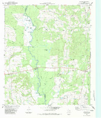
1983 Map of Douglass
USGS Topo · Published 1983About this map
The Angelina River meanders southward through the center of this landscape, forming the natural boundary between Cherokee and Nacogdoches Counties. This riverine environment is defined by complex oxbows and backwaters, including Blue Lake, Brushy Lake, and Horseshoe Lake, alongside the extensive Duck Roost Slough. The settlement of Douglass anchors the eastern side of the quadrangle, while the rural communities of Stillhouse, Lilbert, and Linwood are scattered across the surrounding uplands. Local history is deeply embedded in the land through numerous family and community burial grounds such as Stonewall Cem, Selman Cem, and Redland Cem. In the southern half of the map, the development of the Oil Field is evident, with numerous Oil Wells and Gas Wells punctuating the terrain between Bingham Creek and King Creek. Near the river crossing, a Roadside Park and a Gaging Station indicate the intersection of public infrastructure and the waterway.
Find a feature on this map
41 named features on this map. Tap any name to fly to it.
Don’t see what you’re looking for? This feature index may not catch every label — zoom into the map to look around manually.
Map Details
Editions of this 1983 Douglass Map
This is the sole edition of this map. No revisions or reprints were ever made.
Other maps of this area

1943 · Cushing
USGS Topo · 1:62,500

1943 · Rusk
USGS Topo · 1:62,500

1945 · Cushing
USGS Topo · 1:62,500

1945 · Rusk
USGS Topo · 1:62,500

1946 · Alto
USGS Topo · 1:62,500

1952 · Douglass
USGS Topo · 1:62,500

1953 · Palestine
USGS Topo · 1:250,000

1957 · Palestine
USGS Topo · 1:250,000

1973 · Cushing
USGS Topo · 1:24,000
1973 · Atoy
USGS Topo · 1:24,000