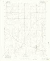
1964 Map of Dove Creek
USGS Topo · Published 1968About this map
Dove Creek serves as the central hub of this agricultural and ranching landscape during the mid-1960s, located just miles from the Utah border. The town is marked by its essential community infrastructure, including a Grain Elevator, Water Tank, and an Athletic Field, reflecting its role as a regional trade center. Transport and utility networks are prominent, with a large Pipeline cutting across the terrain and the Municipal Airport situated southeast of the main settlement.
Find a feature on this map
20 named features on this map. Tap any name to fly to it.
Don’t see what you’re looking for? This feature index may not catch every label — zoom into the map to look around manually.
Map Details
Editions of this 1964 Dove Creek Map
3 editions found
Other maps of this area

1886 · Abajo
USGS Topo · 1:250,000

1892 · Abajo
USGS Topo · 1:250,000

1893 · Abajo
USGS Topo · 1:250,000

1949 · Egnar
USGS Topo · 1:24,000

1949 · Joe Davis Hill
USGS Topo · 1:24,000

1950 · Joe Davis Hill
USGS Topo · 1:24,000

1950 · Egnar
USGS Topo · 1:24,000

1956 · Cortez
USGS Topo · 1:250,000

1957 · Cedar 3 NW
USGS Topo · 1:24,000

1957 · Monument Canyon
USGS Topo · 1:62,500