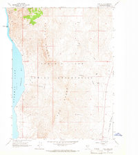
1964 Map of Dove Creek
USGS Topo · Published 1965About this map
Lake Range dominates the interior of this high-desert landscape, creating a dramatic vertical contrast with the western waters of Pyramid Lake. This mid-century survey shows the area within the Pyramid Lake Indian Reservation, where the shoreline of Artillery Bay is marked by distinctive coastal features like Blizzard Camp Point and the steep Howitzer Slide. The geography is defined by narrow canyons and isolated water sources, including Sevenmile Spring and the ephemeral Dove Creek.
Find a feature on this map
18 named features on this map. Tap any name to fly to it.
Don’t see what you’re looking for? This feature index may not catch every label — zoom into the map to look around manually.
Map Details
Editions of this 1964 Dove Creek Map
2 editions found
Other maps of this area

1886 · Granite Range
USGS Topo · 1:250,000

1890 · Wadsworth
USGS Topo · 1:125,000

1891 · Reno
USGS Topo · 1:125,000

1892 · Wadsworth
USGS Topo · 1:125,000

1893 · Reno
USGS Topo · 1:125,000

1894 · Granite Range
USGS Topo · 1:250,000

1894 · Wadsworth
USGS Topo · 1:125,000

1955 · Lovelock
USGS Topo · 1:250,000

1957 · Sutcliffe
USGS Topo · 1:62,500

1957 · Nixon
USGS Topo · 1:62,500