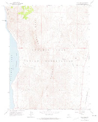
1964 Map of Dove Creek
USGS Topo · Published 1974About this map
The Pyramid Lake Indian Reservation dominates this 1964 survey of the Nevada high desert, where the eastern shoreline of Pyramid Lake meets the stark topography of the Lake Range. The terrain is defined by steep elevation changes, from the waters of Artillery Bay at 3,792 feet to the peaks overlooking Big Basin. Rare water sources like Sevenmile Spring and various unnamed springs provided vital points of orientation in this arid landscape. Transport across the reservation was limited to a few unimproved routes and a Jeep Trail, illustrating the isolation of the area during the mid-20th century. Notable landforms including Howitzer Slide and Blizzard Camp Point mark the rugged northwestern edge of the sheet, while a lone Well and a Gravel Pit indicate the minimal human industrial footprint in this remote portion of Washoe County.
Find a feature on this map
20 named features on this map. Tap any name to fly to it.
Don’t see what you’re looking for? This feature index may not catch every label — zoom into the map to look around manually.
Map Details
Editions of this 1964 Dove Creek Map
2 editions found
Other maps of this area

1886 · Granite Range
USGS Topo · 1:250,000

1890 · Wadsworth
USGS Topo · 1:125,000

1891 · Reno
USGS Topo · 1:125,000

1892 · Wadsworth
USGS Topo · 1:125,000

1893 · Reno
USGS Topo · 1:125,000

1894 · Granite Range
USGS Topo · 1:250,000

1894 · Wadsworth
USGS Topo · 1:125,000

1955 · Lovelock
USGS Topo · 1:250,000

1957 · Sutcliffe
USGS Topo · 1:62,500

1957 · Nixon
USGS Topo · 1:62,500