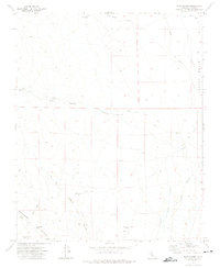
1972 Map of Dove Spring
USGS Topo · Published 1975About this map
Mining operations and water infrastructure dominate this Mojave Desert landscape in the early 1970s. The presence of the Los Angeles Aqueduct and the Second Los Angeles Aqueduct cutting across the eastern portion of the Indian Wells Valley illustrates the region's critical role in California's water management. Small-scale mining efforts are scattered throughout the canyons, including the San Antonio Mine, Lone Star Mine, and Granite King Mine, highlighting the area's mineral prospects. Vital water sources for travelers and miners alike are marked at Dove Spring, Butterbredt Spring, and Bird Spring. Notable local landmarks such as Bishops Claim and Graves suggest a history of prospecting and personal stories etched into the arid terrain, while a network of Jeep Trails provides access to remote reaches like Alphie Canyon and Butterbredt Canyon.
Find a feature on this map
20 named features on this map. Tap any name to fly to it.
Don’t see what you’re looking for? This feature index may not catch every label — zoom into the map to look around manually.
Map Details
Editions of this 1972 Dove Spring Map
2 editions found
Other maps of this area

1906 · Kernville
USGS Topo · 1:125,000

1908 · Kernville
USGS Topo · 1:125,000

1915 · Searles Lake
USGS Topo · 1:250,000

1915 · Mojave
USGS Topo · 1:125,000

1943 · Inyokern
USGS Topo · 1:62,500

1943 · Cross Mountain
USGS Topo · 1:62,500

1943 · Saltdale
USGS Topo · 1:62,500

1943 · Onyx
USGS Topo · 1:62,500

1947 · Trona
USGS Topo · 1:250,000

1948 · Trona
USGS Topo · 1:250,000