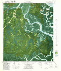
1979 Map of Dover Bluff
USGS Topo · Published 1980About this map
Hazzards Neck and the meandering reaches of the Little Satilla River dominate this 1970s orthophotomap, where the Georgia coast dissolves into a complex network of salt marshes and tidal creeks. This specific survey type overlays topographic contours and bathymetric soundings onto aerial photography, providing a clear view of the transition between solid ground and the wetlands of Colonels Island and Jointer Island. The landscape is dotted with small, family-named landings and points of interest such as Hickory Bluff and Piney Bluff, reflecting a deeply rooted coastal community. Notable for local historians are the Old Spanish Mission Ruins near Honey Creek, alongside spiritual and social centers like Mt Sinai Ch and Ella Park Ch. The map also captures infrastructure like McCarthy Bridge and the Georgia Conference Center, while documenting the precise locations of the Hull Cem and Ella Park Cem.
Find a feature on this map
33 named features on this map. Tap any name to fly to it.
Don’t see what you’re looking for? This feature index may not catch every label — zoom into the map to look around manually.
Map Details
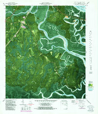
Editions of this 1979 Dover Bluff Map
2 editions found
Other maps of this area

1918 · Cumberland Island
USGS Topo · 1:62,500

1918 · Bladen
USGS Topo · 1:62,500

1918 · Kingsland
USGS Topo · 1:62,500

1930 · Cumberland Island
USGS Topo · 1:62,500

1939 · Bladen
USGS Topo · 1:62,500

1945 · Brunswick
USGS Topo · 1:62,500

1945 · Cumberland Island
USGS Topo · 1:62,500

1946 · Brunswick
USGS Topo · 1:250,000

1948 · Jacksonville
USGS Topo · 1:250,000

1948 · Brunswick
USGS Topo · 1:250,000