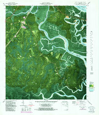
1979 Map of Dover Bluff
USGS Topo · Published 1988About this map
Little Satilla River and the Turtle River dominate this coastal landscape, winding through the expansive Hardee Swamp and the tidal marshes of Hazzards Neck. The map provides a detailed view of the water-bound geography of Colonels Island and Jointer Island, where the complex network of Sam Creek and Maiden Creek meets the sea. Settlement patterns follow the higher ground at the river bluffs, including Hickory Bluff and the coastal community of Dover Bluff.
Find a feature on this map
34 named features on this map. Tap any name to fly to it.
Don’t see what you’re looking for? This feature index may not catch every label — zoom into the map to look around manually.
Map Details
Editions of this 1979 Dover Bluff Map
2 editions found
Other maps of this area

1918 · Cumberland Island
USGS Topo · 1:62,500

1918 · Bladen
USGS Topo · 1:62,500

1918 · Kingsland
USGS Topo · 1:62,500

1930 · Cumberland Island
USGS Topo · 1:62,500

1939 · Bladen
USGS Topo · 1:62,500

1945 · Brunswick
USGS Topo · 1:62,500

1945 · Cumberland Island
USGS Topo · 1:62,500

1946 · Brunswick
USGS Topo · 1:250,000

1948 · Jacksonville
USGS Topo · 1:250,000

1948 · Brunswick
USGS Topo · 1:250,000