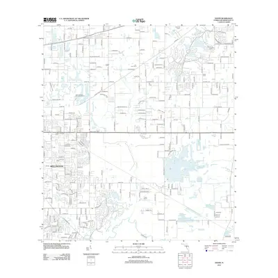
2012 Map of Dover
USGS Topo · Published 2012About this map
Turkey Cr meanders southward through this landscape of the Florida interior, eventually meeting the Alafia River in the southern portion of the quadrangle. The area showcases a transition from agricultural roots to modern infrastructure, evident in the mix of established farming operations like G and F Farms and One Heart Farms alongside commercial developments such as the Shoppes at Brandon Farms. Aviation and utility infrastructure are prominent, with the Plant City Airport at the northern edge and the Valrico Residuals Management Facility toward the west. In the settlement of Wellington, a dense residential grid contrasts with the larger, open parcels and smaller water bodies like Mud Lake found in the rural outskirts. Local landmarks such as the Valrico Lookout Tower and the Lewis Airport further define the geography of this central Florida region.
Find a feature on this map
216 named features on this map. Tap any name to fly to it.
Don’t see what you’re looking for? This feature index may not catch every label — zoom into the map to look around manually.
Map Details
Editions of this 2012 Dover Map
This is the sole edition of this map. No revisions or reprints were ever made.
Other maps of this area

1921 · Tampa
USGS Topo · 1:62,500

1943 · Thonotosassa
USGS Topo · 1:24,000

1944 · Plant City
USGS Topo · 1:31,680

1944 · Mango
USGS Topo · 1:31,680

1944 · Thonotosassa
USGS Topo · 1:31,680

1944 · Antioch
USGS Topo · 1:31,680

1944 · Balm
USGS Topo · 1:31,680

1955 · Lithia
USGS Topo · 1:24,000

1955 · Nichols
USGS Topo · 1:24,000

1955 · Dover
USGS Topo · 1:24,000