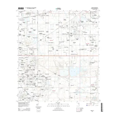
2015 Map of Dover
USGS Topo · Published 2015About this map
Plant City and its surrounding residential developments anchor the eastern edge of this 2015 landscape, where historic citrus groves have transitioned into numerous named neighborhoods. The geography is defined by a dense network of suburban tracts such as Lehman Acres, Waller Acres, and McIntosh Lakes, reflecting the expansion of Hillsborough County in the early 21st century. Aviation history is prominent with both the Plant City Airport and Lewis Airport present, serving the local regional aviation needs. To the south, the Alafia River and Turkey Cr provide natural drainage for the region. The map captures the interface between established settlements like Dover and Bingham and newer residential communities like The Paddocks and West Plant City. This record serves as a primary source for understanding the mid-2010s suburban infill that characterizes the corridor between Tampa and Lakeland.
Find a feature on this map
316 named features on this map. Tap any name to fly to it.
Don’t see what you’re looking for? This feature index may not catch every label — zoom into the map to look around manually.
Map Details
Editions of this 2015 Dover Map
This is the sole edition of this map. No revisions or reprints were ever made.
Other maps of this area

1921 · Tampa
USGS Topo · 1:62,500

1943 · Thonotosassa
USGS Topo · 1:24,000

1944 · Plant City
USGS Topo · 1:31,680

1944 · Mango
USGS Topo · 1:31,680

1944 · Thonotosassa
USGS Topo · 1:31,680

1944 · Antioch
USGS Topo · 1:31,680

1944 · Balm
USGS Topo · 1:31,680

1955 · Lithia
USGS Topo · 1:24,000

1955 · Nichols
USGS Topo · 1:24,000

1955 · Dover
USGS Topo · 1:24,000