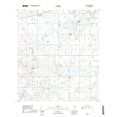
2018 Map of Dover
USGS Topo · Published 2018About this map
Turkey Creek carves a central path through this landscape, which transitions from the industrial and residential outskirts of Plant City in the northeast to the agricultural and suburban grids of Valrico in the southwest. The area is defined by a series of small, historic communities connected by long-standing thoroughfares like Sydney Rd and Hopewell Rd. Settlements such as Dover, Sydney, and Durant appear as established nodes within a landscape of citrus groves, nurseries, and low-lying wetlands. Aviation history is present through both the Plant City Airport and the smaller Lewis Airport to the south. The southern portion of the map is dominated by the extensive marshlands of Williams Swamp, illustrating the natural drainage patterns that have historically shaped land use in Hillsborough County. Researchers can trace the evolution of local infrastructure through the network of county roads and named corridors like Dr Martin Luther King Jr Blvd.
Find a feature on this map
45 named features on this map. Tap any name to fly to it.
Don’t see what you’re looking for? This feature index may not catch every label — zoom into the map to look around manually.
Map Details
Editions of this 2018 Dover Map
This is the sole edition of this map. No revisions or reprints were ever made.
Other maps of this area

1921 · Tampa
USGS Topo · 1:62,500

1943 · Thonotosassa
USGS Topo · 1:24,000

1944 · Plant City
USGS Topo · 1:31,680

1944 · Mango
USGS Topo · 1:31,680

1944 · Thonotosassa
USGS Topo · 1:31,680

1944 · Antioch
USGS Topo · 1:31,680

1944 · Balm
USGS Topo · 1:31,680

1955 · Lithia
USGS Topo · 1:24,000

1955 · Nichols
USGS Topo · 1:24,000

1955 · Dover
USGS Topo · 1:24,000