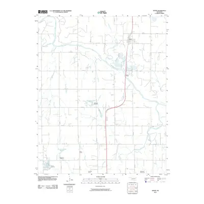
2010 Map of Dover
USGS Topo · Published 2010About this map
Dover serves as the primary hub on this 2010 topographic record of Kingfisher County, situated just north of the Cimarron River. The landscape is defined by the winding river valley and its numerous tributaries, including Turkey Creek, Treaty Creek, and Kingfisher Creek. The presence of several artificial water bodies, such as Oknoname 07312 Reservoir and Lake Elmer, illustrates local water management and agricultural engineering. Aviation infrastructure is surprisingly prominent for a rural district, with both White Airport and Kingfisher Airport located in the southern portion of the quadrangle. Transportation is anchored by the crossing at Boecher Bridge, connecting the town of Dover to the rolling plains to the south. Local genealogy and history are anchored at the Dover Cemetery, while the network of section line roads like Beebe Rd and E0750 Rd provides a clear view of the area's modern land division and rural property boundaries.
Find a feature on this map
31 named features on this map. Tap any name to fly to it.
Don’t see what you’re looking for? This feature index may not catch every label — zoom into the map to look around manually.
Map Details
Editions of this 2010 Dover Map
This is the sole edition of this map. No revisions or reprints were ever made.
Other maps of this area

1892 · Kingfisher
USGS Topo · 1:125,000

1893 · Hennessey
USGS Topo · 1:62,500

1893 · Loyal
USGS Topo · 1:62,500

1893 · Ames
USGS Topo · 1:62,500

1895 · Kingfisher
USGS Topo · 1:125,000

1954 · Oklahoma City
USGS Topo · 1:250,000

1955 · Clinton
USGS Topo · 1:250,000

1955 · Enid
USGS Topo · 1:250,000

1955 · Woodward
USGS Topo · 1:250,000

1956 · Ames
USGS Topo · 1:62,500