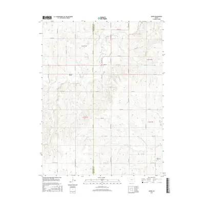
2015 Map of Dover
USGS Topo · Published 2015About this map
The unincorporated community of Dover serves as the focal point for this landscape along the border of Shawnee and Wabaunsee counties. This area is defined by the complex drainage of the Wakarusa River and its Middle Br, which cut through the terrain alongside Mission Creek and the smaller Haskell Cr. Local history and genealogy are anchored by landmarks like the Dover Cem and Saint Bartholomew Cem, while the rugged relief is illustrated by features such as Gladden Ravine. The map details a dense network of county roads, including SW Crawford Rd and Harveyville Blacktop Rd, which connect the rural homesteads and valley farms. Small tributaries like Lomis Cr and Massasoit Cr further delineate the land, showing how water shaped the settlement patterns of this Kansas prairie region.
Find a feature on this map
43 named features on this map. Tap any name to fly to it.
Don’t see what you’re looking for? This feature index may not catch every label — zoom into the map to look around manually.
Map Details
Editions of this 2015 Dover Map
This is the sole edition of this map. No revisions or reprints were ever made.
Other maps of this area

1885 · Eskridge
USGS Topo · 1:125,000

1889 · Burlingame
USGS Topo · 1:125,000

1889 · Wamego
USGS Topo · 1:125,000

1889 · Eskridge
USGS Topo · 1:125,000

1889 · Topeka
USGS Topo · 1:125,000

1894 · Eskridge
USGS Topo · 1:125,000

1894 · Burlingame
USGS Topo · 1:125,000

1894 · Topeka
USGS Topo · 1:125,000

1894 · Wamego
USGS Topo · 1:125,000

1947 · Lawrence
USGS Topo · 1:250,000