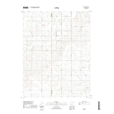
2018 Map of Dover
USGS Topo · Published 2018About this map
The community of Dover sits at the northern edge of this 2018 survey, positioned where SW Douglas Rd meets SW 57th St. The landscape is defined by the winding course of the Wakarusa River and its various tributaries, including the Middle Br Wakarusa River, which flow through the southern portion of the quadrangle. Local heritage and family history are tied to the grounds of Dover Cem and Saint Bartholomew Cem, while the natural topography is marked by distinct features such as Gladden Ravine and Mission Creek. The map documents a rural network of roads like Harveyville Blacktop Rd and Mission Valley Rd, crossing the boundary between Wabaunsee Co and Shawnee Co. This detail provides a clear view of the area's modern agricultural and residential layout, preserving the placement of creek crossings and local cemeteries.
Find a feature on this map
44 named features on this map. Tap any name to fly to it.
Don’t see what you’re looking for? This feature index may not catch every label — zoom into the map to look around manually.
Map Details
Editions of this 2018 Dover Map
This is the sole edition of this map. No revisions or reprints were ever made.
Other maps of this area

1885 · Eskridge
USGS Topo · 1:125,000

1889 · Burlingame
USGS Topo · 1:125,000

1889 · Wamego
USGS Topo · 1:125,000

1889 · Eskridge
USGS Topo · 1:125,000

1889 · Topeka
USGS Topo · 1:125,000

1894 · Eskridge
USGS Topo · 1:125,000

1894 · Burlingame
USGS Topo · 1:125,000

1894 · Topeka
USGS Topo · 1:125,000

1894 · Wamego
USGS Topo · 1:125,000

1947 · Lawrence
USGS Topo · 1:250,000