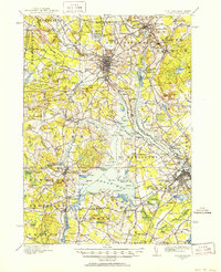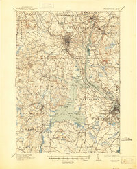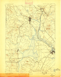
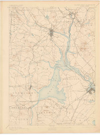
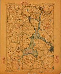
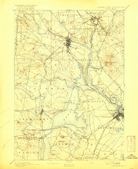
1893 Map of Dover
USGS Topo · Published 1898About this map
The Piscataqua River system and the expansive Great Bay dominate this coastal survey, illustrating the complex maritime and industrial geography at the Maine New Hampshire Boundary Line. In the late 19th century, the city of Dover serves as a major hub where the Cocheco River and Bellamy River converge toward the sea. The landscape is defined by its early rail connectivity, with the Boston and Maine Railroad and its various branches, such as the Portsmouth and Dover R.R., knitting together shoreline settlements and inland depots. This era shows industrial activity at Great Works and a network of tidal inlets supporting towns like Durham, Newmarket, and Portsmouth. Notable landmarks such as Garrison Hill and Dover Point provide topographic context to a region defined by its navigable waters and the Western Division rail corridors that fueled the local economy.
Find a feature on this map
84 named features on this map. Tap any name to fly to it.
Don’t see what you’re looking for? This feature index may not catch every label — zoom into the map to look around manually.
Map Details
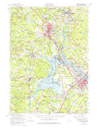
Editions of this 1893 Dover Map
5 editions found

Historical Maps of Dover Through Time
5 maps found