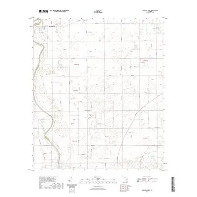
2021 Map of Dowling Park
USGS Topo · Published 2021About this map
The Suwannee River snakes along the western edge of this Florida landscape, defining the boundary between Lafayette Co and Suwannee Co. This karst-heavy region is notable for its high concentration of groundwater features, including Blue Spring, Thomas Spring, Charles Spring, and Allen Mill Pond Spring. These natural outlets were historically vital for local settlements and remain key landmarks in the rural geography.
Find a feature on this map
63 named features on this map. Tap any name to fly to it.
Don’t see what you’re looking for? This feature index may not catch every label — zoom into the map to look around manually.
Map Details
Editions of this 2021 Dowling Park Map
This is the sole edition of this map. No revisions or reprints were ever made.
Other maps of this area

1954 · Day SE
USGS Topo · 1:24,000

1954 · Day
USGS Topo · 1:24,000

1954 · Dowling Park
USGS Topo · 1:24,000

1954 · Valdosta
USGS Topo · 1:250,000

1955 · Mayo NE
USGS Topo · 1:24,000

1955 · Mayo
USGS Topo · 1:24,000

1955 · Mayo SE
USGS Topo · 1:24,000

1958 · Valdosta
USGS Topo · 1:250,000

1958 · Madison SE
USGS Topo · 1:24,000

1959 · Valdosta
USGS Topo · 1:250,000