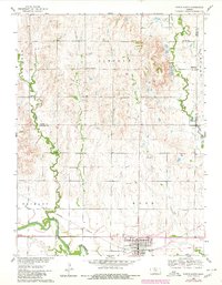
1960 Map of Downs North
USGS Topo · Published 1980About this map
Downs serves as the focal point of this North-Central Kansas survey, situated where the North Fork Solomon River and South Fork Solomon River approach their confluence. The town's layout reflects its importance as a local transportation hub, anchored by the Missouri Pacific railroad line and an Old Railroad Grade that speaks to shifting rail infrastructure over time. The surrounding landscape in Bethany and Ross townships is a mosaic of agriculture and small community institutions, many of which provide vital clues for genealogists researching the area's rural history.
Find a feature on this map
25 named features on this map. Tap any name to fly to it.
Don’t see what you’re looking for? This feature index may not catch every label — zoom into the map to look around manually.
Map Details
Editions of this 1960 Downs North Map
2 editions found
Other maps of this area

1893 · Smith Center
USGS Topo · 1:125,000

1894 · Mankato
USGS Topo · 1:125,000

1894 · Beloit
USGS Topo · 1:125,000

1896 · Osborne
USGS Topo · 1:125,000

1953 · Downs South
USGS Topo · 1:24,000

1953 · Waconda Springs
USGS Topo · 1:24,000

1953 · Osborne
USGS Topo · 1:24,000

1955 · Beloit
USGS Topo · 1:250,000

1959 · Beloit
USGS Topo · 1:250,000

1960 · Downs North
USGS Topo · 1:24,000